Talladega National Forest
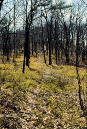
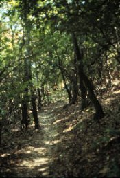
Hiking in Talladega
The Talladega National Forest covers approximately 377,000
acres. The Forest is comprised of 3 Ranger Districts; Talledega, Shoal, and Oakmulgee. The
Talladega & Shoal Creek Districts cover approximately 220,000 acres in Talladega,
Cleburne, Calhoun and Clay Counties. The Oakmulgee Ranger District is comprised of
l56,804-acres located in west Alabama in Bibb, Chilton, Perry, Hale, Dallas and Tuscaloosa
Counties.
Camping & Picnicing
The developed campgrounds and picnic areas on the
districts are listed below. No reservations are accepted; all areas are filled on a
first-come, first-served basis. Campsites will accommodate either tents or trailers.
Drinking water is available in all developed areas. There is a small daily fee at the
areas.
Coleman Lake Recreation Area:
(Shoal Creek District) 39 campsites; 29 picnic sites; group
picnic shelter; flush toilets; showers; swimming. Take U.S. 78 northeast from Heflin for 6
miles; turn left on Forest Service Road 553 for 8.5 miles; then right on Forest Service
Road 500 for 1.5 miles to the lake.
Lake Chinnabee Recreation Area:
(Talladega District) 14 campsites; 8 picnic sites;
picnic shelter; flush toilets. Take Alabama 21 northeast from Talladega for 7 miles; turn
right on County Road 96 for 12 miles; take entrance road 2 miles to lake.
Pine Glen Recreation Area:
(Shoal Creek District) 35 campsites; trailer space;
drinking water; pit toilets; fishing and hiking. Take U.S. 78 west from Heflin for 2.5
miles; then turn right for 8 miles on Forest Service Road 500.
Payne Lake Recreation Area:
(Oakmulgee District) Tent or trailer camping;
picnicking; swimming; fishing; boating; drinking water; sanitary facilities; hiking trail;
trailer dump station. Take U.S. 82 west from Centreville for 2 miles; then south on
Alabama 5 for 6 miles; then west on Alabama 25 for 15 miles.
Primitive camping is allowed in the general forest area of the
Talladega National Forest except during gun-deer hunting season, when camping is confined
to the developed camping areas or hunter camps scattered about the forest. (Hikers may be
permitted to primitive camp during hunting season with written permission from the
District Ranger.)
Hunting And Fishing
The Talladega National Forest includes the Hollins
Wildlife Management Area, on the Talladega Ranger District, and the Choccolocco Wildlife
Mangement Area, on the Shoal Creek Ranger District. Fish and wildlife resources are
managed cooperatively by the Forest Service and the Alabama Department of Conservation
& Natural Resources, Game & Fish Division. The district has numerous areas that
provide excellent fishing. Deer and turkey are popular game species. Motorized vehicles
are prohibited in wildlife openings. Some roads are closed to vehicles, continuously or
seasonally, to benefit wildlife.
Hunting and fishing regulations, including licenses and seasons,
are set and primarily enforced by the state. For information call the Alabama Department
of Conservation & Natural Resources, Game & Fish Division (205) 261-3469.
Shooting Ranges
Henry Creek Shooting Range: located on the Shoal
Creek Ranger District, this range allows visitors to test their skills with pistols or
rifles. Approximately 0.1 miles north of Heflin on Highway 78, turn left onto the
Edwardville Road, continue 2 1/4 miles to Forest Service Road 548, take a left
approximately 1 1/4 miles.
Shepherd Branch Shooting Range:
Located on the Talladega Ranger District approximately 8
miles southeast of Talladega off Highway 77, this range offers visitors several shooting
booths with accommodations for pistols and rifles. Users should bring paper or cardboard
targets only.
Oakmulgee Shooting Range:
This shooting range has several shooting stations to
accommodate pistols and rifles. Firearm users can practice their skills at distances up to
100 yards.
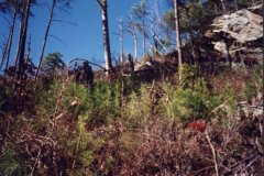
Wilderness
The Talladega District contains the 7,400-acre Cheaha Wilderness.
National Scenic Byway
The Talladega Scenic Byway winds 23 miles along the
backbone of the southern Appalachian Mountains and offers spectacular views of the
Talladega National Forest. The Scenic Byway, which runs from near Heflin along Alabama
Highway 281, climbs to an elevation of 2,407 feet at Cheaha Mountain, the highest point in
Alabama, and ends at the Turnipseed Hunter Camp.
Off-Road Vehicles
Operating an off-road vehicle without a valid motor
vehicle tag on national forests is permitted only on designated trails.
Kentucky Mountain ORV Area:
Located on the Talladega Ranger District, this system
currently has 14 miles of open trail. Future plans are to construct an additional 15 miles
of trail as funds and volunteer efforts are available.
Ranger District Stations:
Forest Supervisor
2946 Chestnut St
Montgomery, AL 36107-
(334) 832-4470
Talladega Ranger District
Highway 21 North
1001 North Street
Talladega, AL 35160
(205) 362-2909
Shoal Creek Ranger District
2309 Alabama Highway 46
Heflin, AL 36264
(205) 463-2272
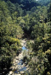
Cheaha State Park
Cheaha State Park is located near Anniston, Alabama, off
I-20 between Birmingham and Atlanta. Cheaha State Park has the highest point in Alabama,
Cheaha Mountain at 2,407'. The Park has motel rooms, cabins, chalets, a group lodge, a
restaurant, and camping facilities. The Park is also located in the center of the
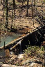
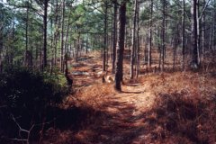
Talladega National Forest which consists of Alabama's longest trail, the Pinhoti Trail.
The Pinhoti Trail stretches over 80 miles north of Sylacauga to near Piedmont and is
presently being extended to near the Georgia state line. Several connecting trails near
Cheaha make that area a great place to hike or backpack. It has also been proposed that
the Pinhoti will eventually connect with the Appalachian Trail. Cheaha also has mountain
bike trails, although I ride often, I rarely bike on vacation, I would rather pack!
Cheaha's wilderness area is very beautiful, unless you drive a
RV, I would recommend camping there. The improved sites are very domesticated, and do not
offer the "experience" the wilderness area has to offer. The restaurant has a
very nice setting and view, although when I ate there, the service was rushed, the food
was cafe' style for restaurant price.
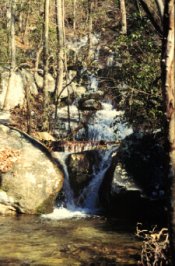
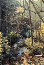
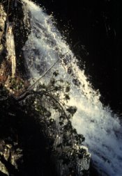
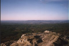
Cheaha has many beautiful trails within the park, which range
from leisure garden trails, to scenic overlooks that are amazing. Pulpit Rock Trail is my
favorite because the panoramic view over the Talladega National Forest, the trail leads to
a huge rock which seems to be falling off the mountain. Bald Rock Trail is equally as
beautiful, I enjoyed seeing where the creeks have carved the entire area into a puzzle.
Directions:
From Interstate I-20 b/w Birmingham and Atlanta,
take exit #191 and go South on Hwy. 431, take a
right on Hwy. 281 stay strait and follow the signs.
Park Office:
	19644 Hwy. 281
	Delta, Al. 36258
Phone:	(205) 488-5111
Hiking Link: Trail Information
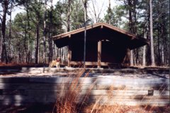
The Pinhoti National Recreation Trail System runs
through the districts from Chandler Springs to Dugger Mountain. There is one shelter
between Adams Gap and Cheaha State Park, one between Cheaha State Park and Pine Glen and
one between Pine Glen and Coleman Lake. Several additional trail sections, that are part of the Pinhoti National Recreation Trail
System, also provide outstanding hiking opportunities.