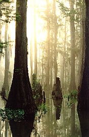
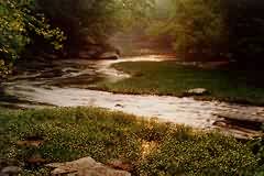
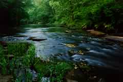
The Cahaba River
The Cahaba River is approximately 190 miles long from its headwaters,
in St. Clair County to its confluence with the Alabama River in Dallas
County. The Cahaba River begins at an underground spring in the Appalachian
foothills, crosses the rocky streambeds of the Piedmont Plateau, and
confluences in the Coastal Plains' Mobile-Tensaw Delta, draining an area of
approximately 1,825 mi2.
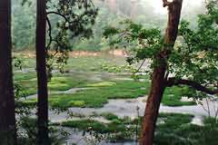
The Cahaba River basin supports 69 rare species, including 10 species that
are listed under the U.S. Endangered Species Act. It has more fish species,
131, than any river of its size in North America.
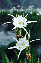
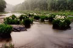
The Cahaba watershed is a treasure of botanical life as well. As the Cahaba
flows southward into rural Bibb County, it shelters the largest known stand
of the imperiled shoals lily (Hymencocallis coronaria). Celebrated
locally as the Cahaba lily, this spectacular and delicate flower grows in
the middle of the river, wedging its bulbs into crevices in the limestone
rock.
Almost 50 percent of all documented U.S. species extinctions since European
settlement have occured during this century in the Mobile River basin.
Alabama has the unfortunate distiction of being the most extinction-prone
state in the continental United States, with 98 species extinct.
The Cahaba River is rich in biodiversity but is not immune to this danger.
There are currently many organizations dedicated to the protection and
conservation of the Cahaba River:
The Cahaba River Society,
The Cahaba River Coalition,
Cahaba Trace Commision,
and Rivers of Life.
Alabama Small Boats
Cahaba River Publishing
Pratt's Ferry Preserve
Barton's Beach on the Cahaba River
Upper Cahaba River Threatened
Alabama Rivers
Booth's Ford
Hwy 52 - Slab Page
Pictures by Beth Maynor Young of: Cahaba River Publishing.